This page is updated regularly – do come back soon – and any suggestions welcome!
General
Layers of London is a map-based history website. See free historic maps of London and add stories, memories and histories. Particularly see the local Along the Rainbow collection.

Great site for finding high quality images of historic maps. Zoom in to the area you’re interested in and hover over the search results on the right to see the area covered by each map
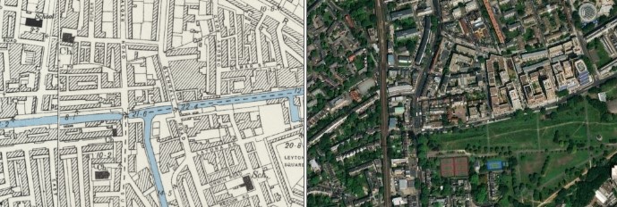
Side-by-side (via the National Library of Scotland website )allows geo-referenced (locked together) historic and modern maps to be used to trace old and new features. Choose the time period for your old and new maps.

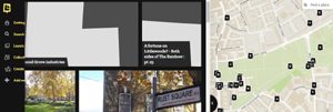
A project creating street histories for the areas of London and surrounding counties lying inside the M25. Comprehensive range of maps and photos.

Great site for local history info

Search London Metropolitan Archives historical image collections
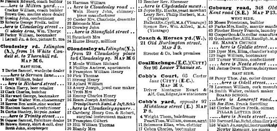
Kelly’s London Suburban Directories, such as this one for 1899, give details of all the businesses and well-to-do people in the area. Search by street name, if known (omit St. / Rd. etc or it will find thousands!). Works best in Firefox

Showing the bombs which fell on the park area during the London Blitz, 1940/1 (Site not working correctly, July 2026)
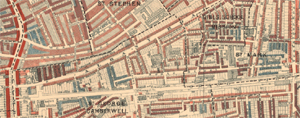
Charles Booth’s very useful ‘Maps Descriptive of London Poverty‘ show, street by street, the level of poverty he assessed in each local area of London, around 1890.

Blogs about the whole of London – this page covers Earl’s Sluice and the wharves at the western end of the park, based on map information

‘The leading source of historical information on industry and manufacturing in Britain’. Detailed directory on many of the former industries in the area, for example, the canal

Some fine views of the park and people, circa 1984

Southwark Council film made after the reopening of the park in 2012, following the £6m rejuvenation

Southwark News page on Burgess Park, but see also many other local history articles

Londonist: Excellent site for all things London
Grand Surrey Canal
London’s Lost Rivers – website and book, which both have a section on the Canal. Look out for Paul Talling’s very popular guided walk of the canal route

Derelict London – sister site to the above – images of industrial decay (not specific to Burgess Park)

Site with loads of information and images on the history of the canal
London Canals – 8 pages covering the Grand Surrey route, with photos

Museum of London in Docklands, which includes the archives of the Grand Surrey Canal. You need to arrange a visit in advance
London Canal Museum at Kings Cross – has an interesting section on Ice Wells mentioned on our page and a small note on the Grand Surrey Canal. Well worth a visit!

A site mainly dedicated to narrowboat canals, but with a lot of interesting info on working with horses which would apply to the Grand Surrey Canal