When the park was conceived, back in the dark days of WW2 (see Abercrombie Plan and Jessie Burgess here), there was a perception of overcrowded areas needing the space of a new park to breathe. As the area around the canal was becoming ‘post-industrial’, and was surrounded by dense, poor quality housing, this part of south London was picked out as a good location for a new park.
The park has developed over the years and had large amounts of money spent on beautifying it and improving the facilities for the surrounding population. Planners and supporters have endeavoured to do this in a balanced way, at the same time providing wildlife havens and linking up with other small pockets of green in the area to create wildlife corridors. Many of the wildlife areas have been created out of parcels of Metropolitan Open Land – a designation similar to the Green Belt around London, designed to protect the few remaining areas of green space in the inner city.
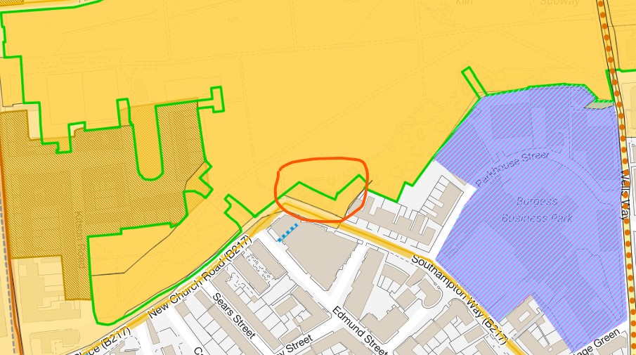
Originally, these areas of MOL were then compulsorily purchased in order to legally become parkland. However, that system of taking over land became unpopular and more and more expensive as land prices in the city have risen. This has meant that various areas of MOL have been left in limbo – intended to be incorporated into the park, but remaining in private ownership. There have been several campaigns in the past to try and ensure the MOL designations in the park are respected – see Southwark News article here. One recent successful application of the principle of MOL has been in the deal done by the Council with the owners of a property in Parkhouse Street. This had an historic spur of land, used as a parking area, jutting into the park and splitting the wildlife area in two. It’s since been fully incorporated into the park and landscaped to match the surrounding area.
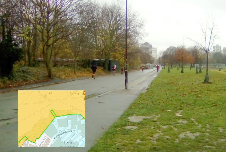
Former police vehicle yard in2918 (visible in the trees on the left) jutting into the park right up to the now removed New Church Road. Inset map shows it as green outlined finger in the orange MOL.
Now that the park has become extremely desirable, it’s attracting many new housing developments to the area, at just the same time as it’s attracting more visitors. Most of the north side of the park, originally the Aylesbury estate, is being replaced with a mixed private/public estate which will see a lot more tall blocks overlooking the park, selling for high prices because of their park view. A lot of the south side is so far still industrial land, to the north of Parkhouse Street, with low-rise former industrial premises and factories. However, there have already been several planning applications to replace 3 or 4 industrial premises with around 275 flats, at 9, 10 and 11 stories, right up to the park boundary. On the other side of Parkhouse Street, is the proposed Camberwell Union development of 500+ flats. We consider this to be over-development, in all kinds of ways.
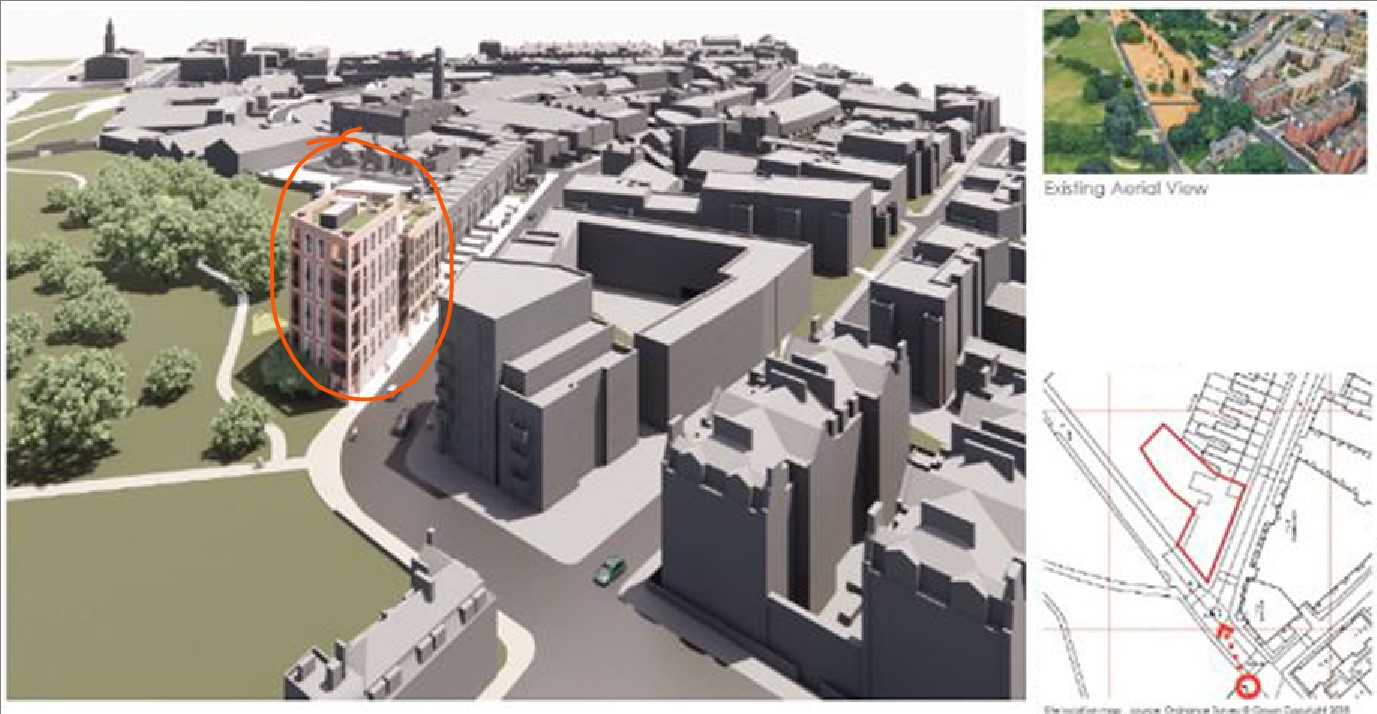
However, a still more worrying development is the plan to replace the long-standing reclamation yard at the corner of New Church Road/Southampton Way (13 Southampton Way). This is on one of the final unincorporated pieces of Metropolitan Open Land, which was always planned to be part of the park. The proposal to build 4 and 7 story blocks right on the corner, adjoining the well-developed wildlife sanctuary will be a big mistake. Like the Parkhouse Street developments, it will overshadow the wildlife area and wildflower meadow, blocking sunlight from acres of ground in the winter. It will make the corner in the road very constricted for traffic and for pedestrians entering and leaving the park, and disrupt wildlife routes.
Please sign the petition being raised by Burgess Park Action Group here. Please also get involved with the work of Friends of Burgess Park to protect the park from over-development of surrounding streets, to the detriment of the park, its users and wildlife.