OK, so what is the Bridge to Nowhere and how did it get this name? The bridge has somehow come to symbolise Burgess Park, together with the butterfly, the Camberwell Beauty. Between them, they reflect both the industrial heritage and the natural aspect of the modern park, created after World War 2 by clearing a busy industrial and residential area. Although now ‘going nowhere’, the bridge was once a vital artery connecting a community split in two by the wide, busy canal traversing the entire length of what is now Burgess Park. Actually – the bridge really is going somewhere, now that it’s been renovated by Southwark Council!
When the Canal first opened in 1811, the area was mainly agricultural, with meadows and market gardens on either side, and few roads. An old lane ran north-south approximately where Wells Way lies now, and another footpath further east between the Old Kent Road and Peckham, now Trafalgar Avenue. Both these routes required a canal crossing, and were initially supplied with small wooden swing bridges, which were later enlarged.
As the park area became more and more built up in the 19th century, having only two crossings for almost a mile of wide canal became more and more problematic. The banks of the canal and land either side had become crowded with houses and businesses divided by the canal. Judging by the number of drownings in the canal, some people were trying to wade or swim across, and one wood-yard near St George’s Church had taken to rafting across with their goods.
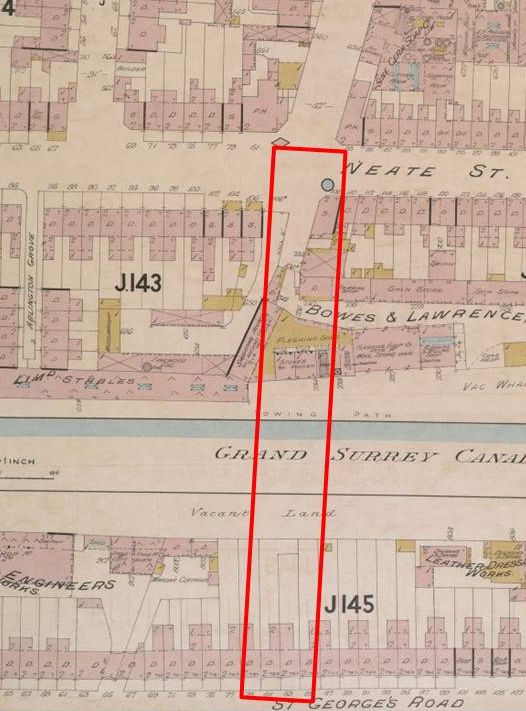
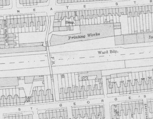
By 1894, public meetings were being held, and Camberwell St Giles Vestry (the local council) agreed that an additional bridge was required, and took on the task. (Not the canal company, interestingly, who might be thought of as causing the problem!) However, things moved slowly, and it was not until 1902 that the Board of Works of the now Camberwell Borough Council put forward a scheme for a footbridge, in a choice of two locations, linking St Georges Way on the south side of the canal with Neate St on the north, between Wells Way and Trafalgar Avenue.
Discussions took place with the Surrey Commercial Dock Company, who had their own stipulations, and with London County Council, who oversaw infrastructure for the borough councils in the capital, and could finance such a project. Agreements were reached and a loan for some of the estimated £7000 costs found. Slight wobbles were overcome by 1904, such as several people (including the Town Clerk) proposing a vehicle rather than pedestrian bridge (a wholly different proposition), and ratepayers objecting to the spending (‘no urgency has been shown for the need of such a bridge’). The bridge was designed by the Borough Engineer and plans approved, together with a recommendation to use local unemployed labour where possible, in November that year.
In early 1905, the LCC paved the way for compulsory purchase of the properties on either side of the canal (costing £2,848) to allow access to the bridge, and the construction work was tendered out. The lowest tender was from a firm in Monmouth, but the Works Committee’s recommendation was overruled, and the Council went with the second lowest quote of £3,969, from Henry Woodham and Sons of Catford. This was a local road builder, still going in the 1950s when their steamrollers were a familiar sight in the area (see https://runner500.wordpress.com/2017/01/05/henry-woodham-sons-and-the-catford-steamrollers/ ).
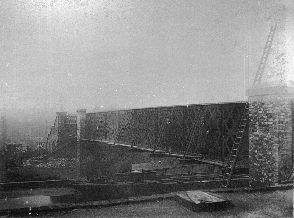
The photograph is taken from on top of the Strong and Rawle sheepskin/fleece factory (which a short while later became a printing works) on the north side of the canal. Houses on St George’s Way are just visible on the left of the image. The canal at this point has clearly been drained to aid the construction, with a lighter (barge) placed underneath, presumably to allow access over the otherwise muddy canal bed.
Did you spot the two gents standing on boards on the side of the bridge? Presumably working on the bridge, nevertheless they have turned out very smartly for the photographer, in suit and tie! Or perhaps they’re foremen, or one of them is even the Borough Engineer, William Oxtoby, who designed the bridge. The photo above has been enhanced to make detail visible, but the original can be seen in the blog here.
The Council minutes of 19th July 1905 report that work had commenced, and the Borough Engineer told the January 1906 meeting that the bridge would be ready to open on 29th. The following month’s Council meeting heard a full report of the opening ceremony, which took place at 3.30pm on Monday 29th January 1906. As well as a large number of local residents, 18 Aldermen and Councillors were present, together with the Mayor, who declared the bridge open. The usual thanks were issued to one and all, especially the Borough Engineer, William Oxtoby, and his department.
The bridge was described as, and still remains:
A steel lattice girder bridge of 3 spans, total length including approaches – 410 feet [125m]. The central span over the canal and towpaths each side is 80 feet [24m]. [The canal here was said to be the widest in Camberwell at 70 feet.] The bridge is floored with oak planks [7ft, 2.2m above the water] and the approaches with asphalt and stone cobbles. An additional access road to the canal was built from St Georges Way. The bridge was tested with 75 tonnes and found to flex in the centre by 3/8 inch [about 1cm]. It was completed 2 months ahead of contract, and under budget.
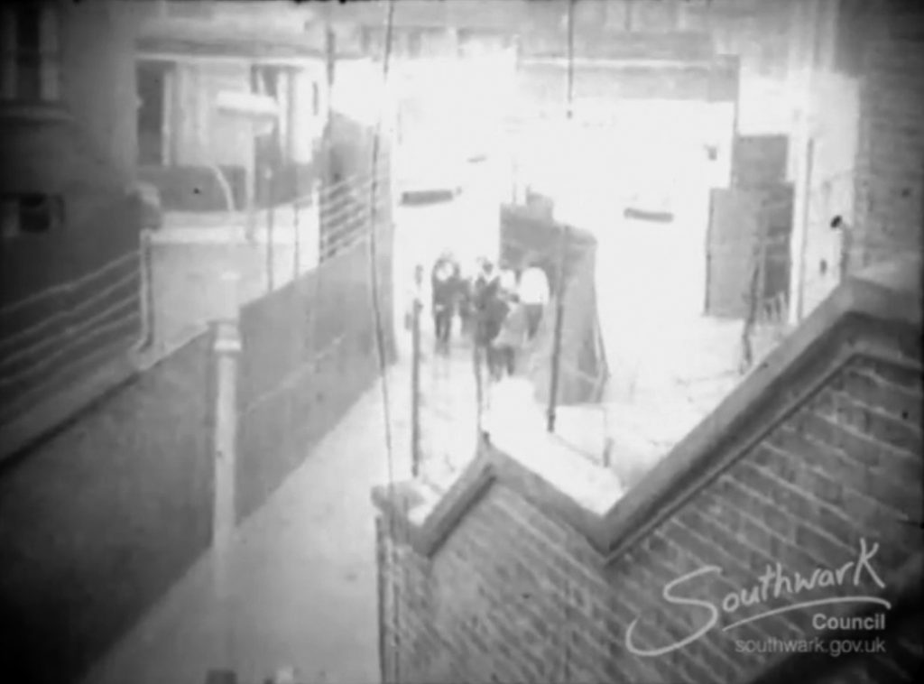
The bridge features in a film made by pupils of Walworth School in 1962 – ‘Two Bobs’-worth of Trouble’ (https://www.youtube.com/watch?v=d9iTsUrEgzw&ab_channel=LondonsScreenArchive) – search for 20 minutes in. You can see first the northern approach from Neate St, then the southern exit to St George’s Way.
The canal was closed between 1960 and 1970 and filled in, the factories and houses demolished to make way for the park, and the bridge eventually left stranded in a sea of green. It became progressively less safe and the steps and deck closed to the public in the early 1990s.
That the bridge still stands is a tribute to Camberwell Council, for the quality design and build, and also to Southwark Council who made a beautiful job of the 2023 renovation. This should ensure that it lasts well into the future, not as an entirely useful bridge, but more as a sculptural reminder of the industrial heritage and amazing transformation of the Burgess Park area. You can read about the renovation on our website here.
A version of this article appeared in Camberwell Quarterly, Summer 2023 edition. With thanks to the staff of Southwark Local History Library and Archives for supplying the Minute Books and images.
The Bridge to Nowhere Art Project
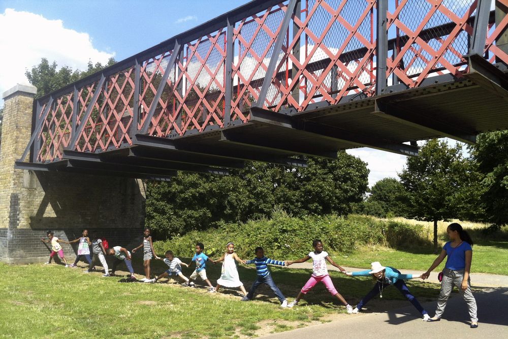
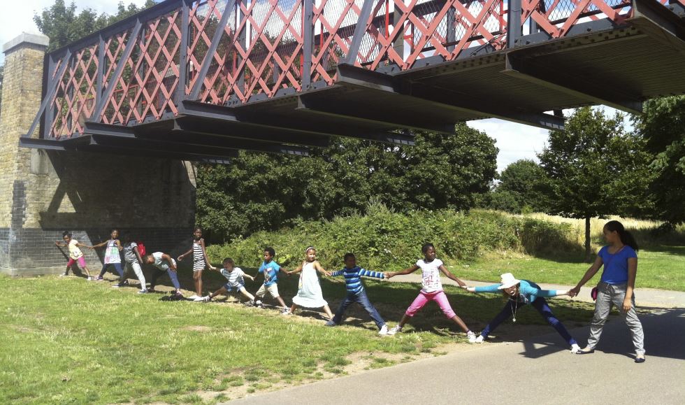
In 2014, the Friends of Burgess Park invited resident Art in the Park artists to work with local young people aged between 7-14 years old to find the answer. Exploring the park with a historical map, the children were able to discover the lost Grand Surrey Canal. They stretched arms across the bridge and concluded that it took 30 children to equal the width of the canal.
Using imagination and role-play they became a working barge (or was it a pirate ship?) with others pulling cargo down the canal. They realized that, while being a child back then was hard work fraught with danger, it also seemed very exciting!
They imagined where local industries would have been and discovered that one was a lemonade factory – which brought Charlie and the Chocolate factory to mind. A tasting session was required to see if R. Whites is the fizziest lemonade!
Walking to the Lime Kiln some thought they saw a castle, but with research they learned how the kiln made lime to help build houses. Though hot and difficult, some thought it would have been a great job for keeping warm in winter.
Children looked at the vivid blues of the Camberwell Beauty butterfly, and imagined how they could incorporate these colours into their own work.
The children then worked in drawing, painting, wood carving, plaster casting and brick making, recreating the factories’ smoky chimneys, barges and the flowing water of the canal itself.
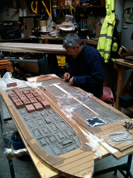
This art process can now be seen at the underpass in Burgess Park. It is the children’s reinterpretation of the barges and the materials they once transported back and forth along the canal such as bricks, lemonade bottles, shells, timber and printed books. Read about the opening of the artwork in our blogpost.
Credits:
Thank you to the young artists that took part in The Bridge to Nowhere Underpass project:
Shakira Waite-Gordon
Kai Campbell
Finn Wharton
Amon Alem
David Daramola
Jacqueline Achiburi
Amy Daley
Siggy Mignott
Rianna Virgo
Siqourney Mignott
Shamiah Waite – Gordon
Eniloa Ayomide
Phebe Davies-Bates
Lucy Webb
George Webb
Davina Daramola
Maya Howard
Sidje Nichoh
Bo Jenkins
Tiana Page
Additional thanks to the following people who helped with this project: Pauline Smith, Carol Dalton, Michael Faraday School, Southwark Play Service.
About the bridge that still stands in the park – my father Thomas Savill was in the home guard. With another home guard they had to stay on the bridge during the war to protect it. My father, who could do anything with wood, decided to make a fake rifle he nearly ended up in the guard-house as they thought he had a real rifle!
Sadly he passed away at the age of 91. We all lived in Cator Street till they moved everyone out in the 60s.